Tuesday, February 15, 2011

Arroyomolinos

1.
                    World map:
                                In red is marked Spain.
                   Europe:
                               In green is marked Spain.
                    Spain:
                              In pink is marked Madrid.  
                     
                 Madrid:
                            In red is maked arroyomolinos.
2.
Avila, Segovia, Guadalajara, Toledo and Cuenca surrounds Madrid.
3.
Madrid coordinates are 40º 16´ 9´´ N  3º 55´ 12´´ O


 4/5. Navalcarnero(west), Mostoles( North East), Parque Coimbra(North), Moraleja de enmedio(East)and Cotoredondo(South) are the frontiers of Arroyomolinos.


6.Arroyomolinos is mainly made up of hills and the river that passes near Arroyomolinos is the river Guadarrama.
7.Arroyomolinos climate is mediterranean climate.
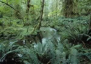
8.Arroyomolinos is sorruonded by a forest called "El pinar                                                                                                     


9. In Arroyomolinos there are about 10.000 inhabitants and you can reach Arroyomolinos throw the A-5or with a bus with numbers 495,497,498 and 499.
10.Arroyomolinos was founded during the Muslim invasion, later to be reconquered by King Alfonso VI of Castile in the decisive step towards recapturing Toledo (1085). By then, the place was known as Chozas Creek.

Other sources however feel that the town was founded in the year 1400, with the same name, later changing to the present. It was during those same years when Pedro I the Cruel Day gave Gomez de Toledo privileged to repopulate the term Arroyomolinos with 80 inhabitants.

Torreón
The most representative of the town and witness its historical exception is the Tower of Arroyomolinos (Pan Tower or Castle Arroyomolinos) is located in the same name, on the west side of Madrid. Is in the same town and mantiente a good state of preservation, having been restored in the early twenty-first century. It was built between the fourteenth and fifteenth centuries, as a lordly tower.

SECOND PART:


2. From the park we could see the frontiers  of arroyomolinos, from the north we could see an urbanitation called parque coimbra and  mostoles that from the distance is a big tonw with high buildings and parque coimbra is a very big urbanitation but like a tonw is very small and it doesn't have tall buildings. On the west we could see Navalcarneroonly a little so we only see the tall buildings. In the same part of the view of Navalcarnero, in the foregound we could see the river Guadarama but only a little.

Wednesday, February 2, 2011

Notebook Unit 5 and 6 Weather and Climate/Climate and Landscape of the Earth

Homework for Thrusday,3 February:

The Earth´s Climates:

 -Equatorial:(in the equator)
      -High temperatures(25º C).
      -Rivers with high regular flow(amazon).
      -It´s vegetations are jungles.
      -So much speices of mammals, birds, reptiles and insects.
      - Inhabitants live from basic farming.


-Tropical:(north and south of equator)
     - High temperatures all year(dry and rainy seasons).
     - River flow depnds on the season(dry in dry season, rise in rainy season).
     - Savannas are typical landscapes.
     - In the savannas there are herbivores and predators
     - Inhabitants depend on livestock, crop rotation, agricultureand plantations.

- Deserts:(in tropics)
    -High temoeratures in the day and low at nigth.
    -No rivers,light and irregular rainfall.
    -Riverbeds that contain only water at cretain times.
    -No vegetation.
    -Inhabitants are pastoral nomads and depend on settlements and oases.

-Oceanic:(between 40º and 60º latitudes)
     -Mild temoeratures.
     -Rivers with high regular flow and light and regular rainfall.
     -Meadows are typical vegetation.
     -Mammals are typical animals.

-Mediterranean:(mainly in mediterranean sea)
    -Summers are hot and winters are mild.
    -Rivers have low irregular flow(Floods).
    -Evergreen trees are common vegetation.
    -Mammals, reptiles, birds, insects are tipical.
    -The land in mediterranean climate is good for farming.

-Continental:(interior europe, asia and north america)
    -Hot summers and cold winters(extremes temperatures)
    -High flow in rivers and little rainfall.
    -Vegetation in the north is taiga and in the south steppes.
    -Taiga is used to make cellulose and steppes to make livestock and cereals.

- Polar:North and south pole:
    -Temperatures very low(between 0º and40º C).
    - Low precipitation(snow).
    -Tundra is the only vegetation.
    -Inhabitants survive hunting.

-High Mountain:(ares above 2500 m)
   -Temperatures are very low.
   -Heavy precipitation.(mountaintop precipitation in snow).
   -Inhabitants survive with livestock.
   -Tourist like climbing and hiking.

Notebook Of Books That We Read In Class

Homework for Monday,17 January:

Here it is the homework about my trip around the world:


At the beginning of the year my mum had the idea of travelling around the world and i ask if it can be in my birthday and she agreed. I was so happy of that. I am going to tell you about my trip:


I leaved my house the fourth of february,in the day of my birthday,that day i went from my house too paris and i visited the eiffell tower, i stayed there for five days and then i got a plane to egypt to see the pyramids, few days later i got another plane and i went to an indian forest,when i arrived to the coast of india i got a shipto japan and now i am in san francisco, passing throw a very long bridge; my mother says that our rute is similar to Phileas fogg´s and i am agree but we are doin it by plane and ship, so we will do it in less time. Next days we are going to visit New york and then to Dublin and i wiil be in madrid before i have to take again a plane to Dublin with my classmates.